
MARCH-APRIL 2007
Modeling Man
Software Creator Uses High-tech Analysis to Quench NIMBY Fires
When the masses equate grid patterns with an assault on cul-de-sac safety, transit with urban blight, shops nearby with city noise, and density with the ruination of the suburban American dream, just how does one waltz into a community planning meeting and convince the Joneses that the new urbanists know what they're talking about?
Veteran planner Eliot Allen believes computer modeling, with hundreds of vivid results, can help remove the fear and loathing that so many homeowner associations, builders, policymakers and suburban-minded, separation-of-uses planners harbor toward traditional neighborhood development.
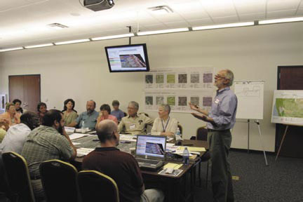
Eliot Allen (at right) discusses the results of his firm’s INDEX analysis during a recent charrette.
Photo courtesy of Criterion Planners
Allen, principal of Portland, Oregon-based Criterion Planners, is the creator of what he has dubbed the nation's leading planning support software: INDEX.
Introduced more than a decade ago and constantly refined and expanded, INDEX uses nearly 80 indicators -- such as land use, transportation, housing, employment, infrastructure and the natural environment -- to measure the outcome of a community plan.
Want to create a superblock here? INDEX software crunches the numbers and spits out a realtime simulation to predict the result. Want to tinker with frontage and a density boost there? Index shows true, predictable results to dispel those hair-trigger, misinformed, NIMBY reactions that can turn a progressive charrette into a public stoning of TND.
"You simulate what's on the ground now, then you run different situations. The indicators are a comprehensive set of land use, transportation and environmental yardsticks," Allen says. "The new urbanism connection is that many of our indicators are measures of the urban environment, the urban pattern that town planners and designers use."
The understated Oregonian takes pride in his proprietary software, but adds, "This is not at all new -- we're measuring the same things Kevin Lynch and Christopher Alexander have written about for years."
Allen, an active member in the Congress for the New Urbanism, said the best way to advocate for new urbanism is to measure its benefits.
"What we can offer to a community and its designers is a very persuasive set of metrics that confirm, that prove the value of new urbanism when it comes to greater travel choices and efficiency, more housing choices, more convenience," he says. "All of those can be reduced to objective arguments that can be presented to a planning commission or city council."
Allen's INDEX has measured new urban projects throughout the country, including brownfield redevelopment and greenfield new towns. INDEX also looks at town plans and measures environmental pollution in terms of global warming, carbon dioxide creation and pollution from storm water runoff.
"During the first energy crisis in 1974, it immediately became apparent that if you were going to pursue energy efficiency and sustainability, urban planners could save enormous amounts of energy in one fell swoop. I instantly realized that you could reduce the energy need in an entire neighbor hood by design, because the energy needs at a neighborhood scale are driven by the kind of decisions made in one planning meeting," Allen explains.
Allen says one way to measure a neighbor hood's efficiency is to calculate the number of centerline miles per square mile.
"We measure the transportation of an urban design with a variety of metrics that describe block length, street grid and density," he says. "Most people think of density as FAR (floor to-area ratio) or density of residents. We look at street density."
A standard grid pattern, because it has more intersections and smaller blocks, would have about 30 centerline miles per square mile. A suburban neighborhood could have low grid density of 8 or fewer centerline miles per square mile.
Higher grid densities produce a multimodal travel environment that can favor walking, biking and transit as much as car use.
"Los Angeles has mid-rise neighborhoods, but people are still using cars because the street grid is so spread out," Allen notes. "Portland, Ore., has short blocks -- some of the shortest grid blocks in America -- with a grid density of about 42."
"In Portland, I have parks, restaurants, neighborhood completeness. You don't need a car to get to a house of worship, the post office, etc.," he says. "You should be able to characterize the richness of your neighborhood by the number of services in your neighborhood."
INDEX, which has been used by more than 130 organizations in 35 states, helped evaluate the performance of post-Hurricane Katrina planning concepts proposed for 11 Gulf Coast cities and three counties. Still, Allen, the veteran of more than three decades of urban planning, quips:
"This is basic urban design -- we've just put it onto GIS software."